MUNICIPALITY: Ravello
NAME: Terraces of Ravello
LOCATION: Loc. Rotonda, loca. Torello, Loc. S. Cosma, Loc. Monte Brusara
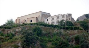
DESCRIPTION: The areas that contain the most terraces are those to the south and north of the slope on which Ravello stands. The southern part can be divided into two subzones. The first (zone A) starts from the locality of Rotonda, overlooks the valley of the Reginna stream (vallata del torrente Reginna*), and reaches the locality of Paradiso. The other (zone B) runs from the locality of Torello to the locality of S. Barbara. Both subzones include lemon cultivation with small areas of olive groves, and in the higher part, there are a few squares planted with vines. The terraces are mostly well maintained, although some of them show signs of neglect. The area to the north (zone C) surrounds Mount Brusara, and is used for the cultivation of vines. Despite the good maintenance of the terraces, is beginning to appear some replacement of chestnut poles with concrete poles.
SEE, VISIT, FIND: In order to cross the terraces and enjoy the view of this highly impactful element, one can choose to walk along the pedestrian roads that lead from the municipality of Ravello to Minori or to the village of Castiglione, which belongs to Ravello. Starting from Piazza Duomo, one can walk for zone A: Via Boccaccio, Via Crocelle, Via Rotonda; for zone B: Via Annunziata, Via S. Pietro, Via S. Cosma, Via Famiglia Bolvito. To see the terraces of Mount Brusara, it is necessary to go to the upper part of Ravello, either by following the roadway from Via Chiunzi or the pedestrian road from Piazza Fontana to Via Monte.
OPPORTUNITY: The opportunity to see terraces both in use and abandoned allows the visitor to understand how this activity influenced and still influences the hydrogeological structure as well as the economy of the Amalfi Coast.


